July 17, 2024
Reading time: 2 minute(s)
Importing data from KML
Reading time: 2 minute(s)
Import data from KML/KMZ files to shapefiles, GeoPackage or Excel file.
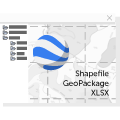
The XTools Pro Import from KML tool allows users to bring KML data into the GIS environment. Users can convert KML features into several supported formats for further processing:
- Shapefile
KML layers will be imported to a zipped file as separate shapefiles. - GeoPackage
KML layers will be imported to a GeoPackage file as separate datasets. - Microsoft Excel file
Attribute data from KML layers will be imported to a single Excel file as separate sheets.
Importing KML data is useful for integrating data collected from different devices, online mapping services, and other external sources:
- Urban planners can import KML files containing site plans, zoning boundaries, or proposed infrastructure projects into their GIS systems.
- KML files containing environmental assessment data can be converted into GIS formats, allowing analysts to overlay this data with other spatial layers to assess potential impacts and plan mitigation measures.
- Emergency managers can import KML files that depict disaster-affected areas, evacuation routes, or locations of critical infrastructure. This data can then be analyzed and integrated with other GIS layers to improve response strategies and resource allocation during emergencies.
- Transportation planners can import KML files containing proposed routes, traffic patterns, or logistics hubs into their GIS systems. It facilitates route optimization, infrastructure planning, and the efficient management of transportation networks.
- KML files with demographic data, market trends, or economic indicators can be imported and analyzed within GIS, helping real estate developers and investors make informed decisions about property investments and market opportunities.
