July 16, 2024
Reading time: 1 minute(s)
Exporting tables to Excel
Reading time: 1 minute(s)
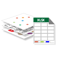
Export records from attribute tables of input datasets to Microsoft Excel files.
The XTools Pro Export to Excel tool is provided to export spatial data attributes to Microsoft Excel file. You can process multiple datasets at once. They will be exported to a single Excel file as separate sheets.
The Export to Excel tool is valuable for a wide range of specific tasks across various fields:
- Researchers and analysts can export attribute tables to Excel to perform advanced statistical analysis using Excel’s built-in functions or other statistical software. This is especially useful for summarizing data, performing calculations, and creating pivot tables to explore data trends and patterns.
- Exporting GIS data to Excel allows for the creation of detailed reports that can include tables, charts, and graphs. These reports can be easily shared with stakeholders, facilitating better communication and decision-making.
- Businesses can export spatial data on customer locations, sales territories, and market demographics to Excel for detailed analysis. That helps in identifying market trends, optimizing sales strategies, and improving customer relationship management.
- Planners can export demographic data, land use information, and zoning details to Excel. It aids analyzing urban growth patterns, planning new developments, and evaluating zoning changes.
