July 2, 2024
Reading time: 2 minute(s)
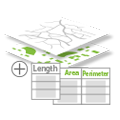
Calculating areas and perimeters
Reading time: 2 minute(s)
Calculate perimeter and area values (including hectares and acres) for polygonal features and length for linear features.
The XTools Pro Calculate Geometry tool is a powerful feature for computing the geometric properties of spatial features. It allows users to calculate perimeter and area values for polygon features and length for line features.
The tool calculates the values in the coordinate system and units you specify including hectares and acres. Also, you can select the method for calculating the distances – planar or geodesic.
- Planar
It refers to the straight-line distance between two points on a flat surface, such as a map or a plane. It is calculated by measuring the length of a straight line connecting the two points without considering the curvature of the Earth's surface. - Geodesic
On the other hand, this method takes into account the curvature of the Earth's surface when calculating the distance between two points. It accounts for the fact that the Earth is not flat and calculates the shortest distance between two points on the Earth's surface along the surface of a sphere or ellipsoid.
The Calculate Geometry tool is crucial for tasks that require accurate spatial measurements:
- Urban planners and developers often need to calculate the area of land parcels for zoning, land use planning, and development purposes. In addition to area, the tool can calculate the perimeter of land parcels, which is useful for determining property boundaries, fencing requirements, and infrastructure planning.
- Environmental scientists can use the tool to calculate the area of various habitats or ecosystems, such as forests, wetlands, or protected areas. This information is critical for biodiversity assessments, conservation planning, and environmental impact studies.
- Researchers can calculate the length of rivers, streams, and trails. This data is essential for hydrological studies, recreational planning, and managing natural resources.
- Property managers and surveyors can verify the size of land plots against official records, ensuring accuracy in property boundaries.
- Farmers and agricultural planners can calculate the area of agricultural fields to plan crop rotations, optimize land use, and manage resources effectively. It helps in precision farming and increasing agricultural productivity. By calculating the perimeter and area of fields, the tool aids designing efficient irrigation systems, ensuring adequate water supply to crops while minimizing wastage.
- Infrastructure managers can calculate the lengths of roads, pipelines, and utility lines. This data is crucial for maintenance planning, resource allocation, and cost estimation.
